
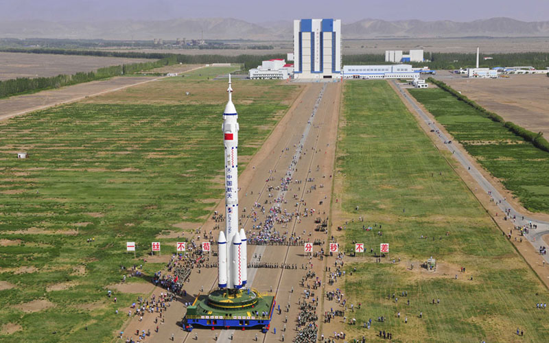
A rocket launch is often described as a contest between thrust and gravity. Before either becomes visible, however, the location of the launch has already narrowed the mission’s options. A spaceport is an industrial system placed on a rotating planet. Its latitude, surrounding terrain, transportation links, weather, and tracking coverage all influence how a spacecraft can leave Earth.
That makes a launch-site profile more than background reading. It helps explain why otherwise similar vehicles serve different missions, why a launch can wait despite an apparently clear sky, and why building a second pad is not the same as doubling a launch program’s capacity. The useful question is not simply where a rocket stands. It is what that place allows the entire operation to do.
The destination begins with the departure point
Earth’s rotation gives an eastward-moving launch an initial contribution to its speed. That contribution is strongest near the equator and decreases toward the poles. ESA identifies this rotational benefit as an advantage of Europe’s Spaceport at Kourou, particularly for missions headed toward geostationary transfer orbit. Latitude is therefore an engineering input, not just a line in a geographic description.
The intended orbit matters as much as the available boost. An orbit’s inclination describes the angle of its plane relative to Earth’s equator. In a straightforward direct ascent, a site’s latitude constrains the low-inclination orbits it can reach without additional maneuvering. A spacecraft intended for a high-inclination orbit cannot simply collect the same eastward advantage and assume the trajectory will work. NASA’s Basics of Space Flight chapter on launch explains this relationship between departure geometry and mission requirements.
There is no universally best latitude. A location attractive for one orbital destination can be less convenient for another. Comparing spaceports without specifying the mission is rather like comparing airports without saying where the aircraft must go.
A safe corridor is part of the design
The rocket does not travel straight upward indefinitely. Its path turns toward the direction needed for orbit, while stages and other hardware may separate below. A launch plan must therefore account for the territory beneath the ascent and for the consequences of a failure. Coastlines can provide useful corridors over water, but the presence of an ocean does not by itself establish a safe trajectory.
Range-safety analysis links flight direction with the locations where hardware might come down. NASA’s Goddard range safety manual illustrates how launch direction and approved operating areas enter the safety process. Restrictions can limit the directions available from a site. A route that requires extra steering may also impose a performance trade-off.
For a reader, this offers a practical distinction: a rocket may be technically capable of carrying a payload, yet the proposed flight from a particular location may require a different trajectory or operating arrangement. Vehicle capability and site suitability are separate questions that have to meet in one mission design.
The coastline also has to receive the rocket
A spaceport is connected to factories long before it is connected to an orbit. Large components must reach the assembly and processing areas without damage. ESA’s account of transporting launch vehicles to Europe’s Spaceport describes the maritime journey from European manufacturing facilities to French Guiana. Port access, handling equipment, and the final movement to the launch base are all parts of the transportation chain.
An island site makes that relationship especially visible. Mitsubishi Heavy Industries locates Tanegashima Space Center on the southeastern end of Tanegashima Island in Japan. Its setting is visually striking, but a mission depends on the facilities and services available there, rather than the appearance of its shoreline. The receiving infrastructure must support the vehicle and spacecraft that actually arrive.
Transport planning creates interfaces that are easy to miss in a launch photograph: packaging must fit handling systems; lifting operations need suitable clearances; and delivery schedules must leave time for processing. These details help explain why a new launcher cannot be treated as an interchangeable visitor to any available pad.
The payload needs its own working environment
Spacecraft preparation is a separate stream of work that eventually converges with rocket preparation. A payload may need controlled environmental conditions, inspections, electrical checks, and a carefully managed integration sequence. NASA’s Launch Services Program fact sheet includes mission analysis, spacecraft integration, and payload processing among the functions of a launch service. Buying the ride involves more than reserving the vehicle.
The site’s processing arrangements must fit the mission’s requirements. A spacecraft team needs to know how it will access its hardware, how testing will be coordinated, and what happens after the spacecraft is enclosed for launch. A delay affecting one activity can change the sequence for the others. Once physical access becomes more restricted, fixing a small problem can demand substantial replanning.
This is also why capacity has several meanings. One facility might process more hardware than a shared range can support, or a pad might be available while the required spacecraft-processing area is occupied. Counting launch pads is a useful starting point, but it is an incomplete measure of the work a spaceport can accommodate.
Weather is a set of engineering limits
A clear view from a camera is not a launch-weather assessment. Conditions at the pad, along the ascent, and inside nearby cloud systems may matter in different ways. NASA’s published Artemis I weather criteria, for example, distinguish conditions for rollout from conditions for liftoff and include constraints involving winds, lightning, and cloud formations. Those criteria belong to that vehicle and mission context; they should not be assumed to apply unchanged to every rocket.
Lightning illustrates why surface appearances can mislead. A rocket passing through an electrically charged environment can face a risk that a person watching the horizon cannot judge. NASA maintains a dedicated standard for lightning launch commit criteria. The existence of such a standard underscores the difference between a weather forecast and a technical decision to authorize flight.
A weather delay should therefore be read as an operating decision with defined constraints, rather than evidence that teams are merely waiting for prettier conditions. The correct limit depends on the vehicle, its ground systems, the flight path, and the approved procedures.
The site must hand the spacecraft over
Launch is also a communications transition. Teams must receive information from the vehicle, follow its progress, and establish the links needed after separation. A successful departure from the pad is only the beginning of that sequence. The geography of antennas and their ability to see a spacecraft become part of the operational plan.
ESA’s Kourou ground-station description identifies work during launch and early orbit operations alongside other mission support. The ground station and the spaceport are distinct facilities, even when their names refer to the same region. A tracking location should not be mistaken for a launch pad, and a launch pad’s location alone does not describe the communications network supporting it.
These handovers provide another way to evaluate a spaceport proposal. The relevant question is not whether an antenna appears in a site photograph, but whether the mission has an established route from ascent tracking to independent spacecraft operations.
Read a spaceport expansion as a systems project
When an announcement promises a new pad or more frequent flights, look for the supporting work. Which vehicles will use the facility? Which orbits are being served? What processing, transport, safety, communications, and personnel resources are shared? The answers make a capacity claim more meaningful than a simple count of concrete structures.
The same approach helps when reading historical launch-site profiles. Preserve the date and distinguish the facilities described at that time from later plans. A proposed improvement is evidence of an intention, not proof that construction or operations followed. A launch site’s significance becomes clearer when geography, infrastructure, and the mission are considered together: the ground is part of the flight system.
Sources and further reading
- NASA: Basics of Space Flight, Chapter 14—Launch
- ESA: Launch site and Kourou’s location
- NASA: Goddard range safety manual
- ESA: Transporting launch vehicles to Europe’s Spaceport
- MHI: Tanegashima launch-site information
- NASA: Launch Services Program fact sheet
- NASA: Artemis I weather criteria
- NASA: Lightning launch commit criteria standard
- ESA: Kourou ground station